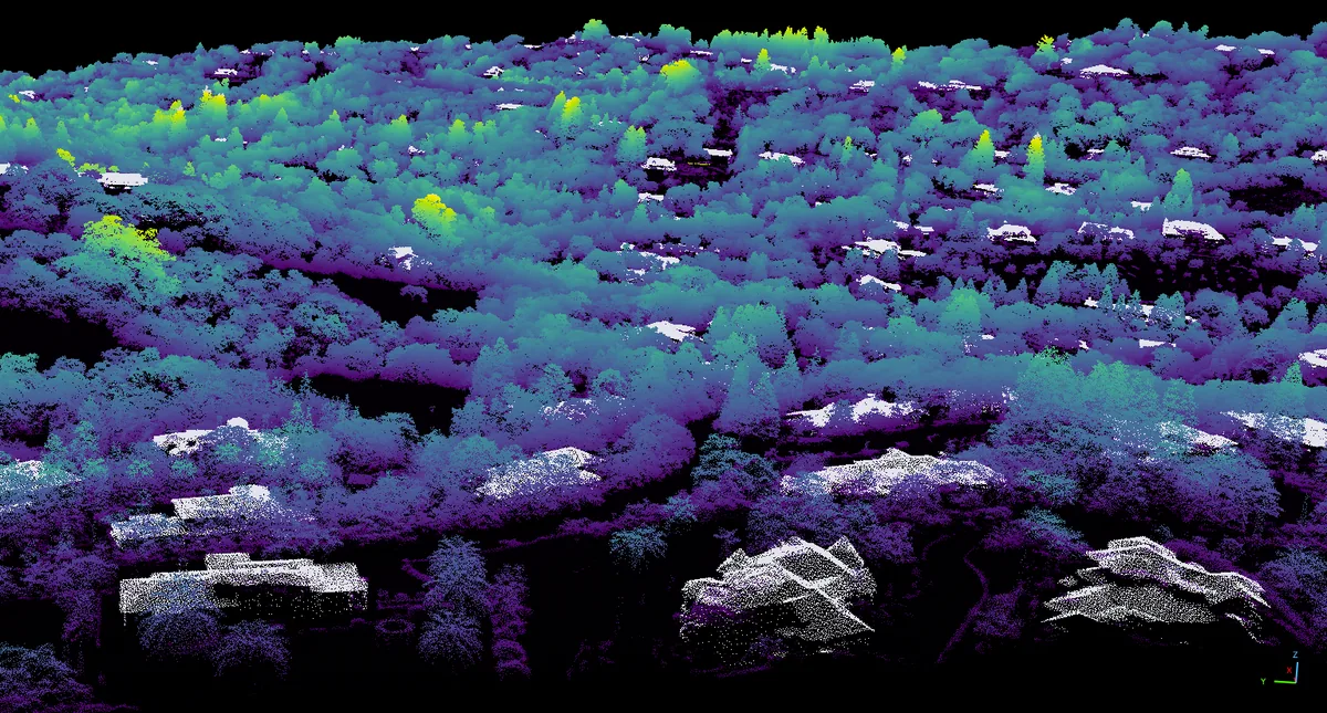
High-Resolution Surface Mapping
Researchers at NASA have produced highly detailed 3-dimensional topography maps covering the entire state of California. This mapping achievement brings surface detail resolution down to the scale of an individual tree.
By integrating advanced airborne and spaceborne observation data, the resulting model offers unprecedented accuracy in characterizing vegetation structure and terrain elevation across the region.
Technical Details and Measurement Scale
The 3D maps capture individual tree heights, canopy density, and the vertical structure of the vegetation layers. Reaching single-tree resolution provides a major technical edge in evaluating fuel load and plant health in forested areas.
The topographic dataset effectively creates a comprehensive digital representation of California's varied landscapes, enabling sophisticated environmental modeling.
Wildfire Risk Assessment and Future Impact
The primary application of these detailed maps is assessing and mitigating wildfire risks across California. Precise data on individual trees enhances predictive models that simulate fire behavior and spread patterns.
This NASA initiative supplies vital intelligence for disaster management teams while serving as a baseline dataset for future ecological and environmental research.

Comments
Loading comments...