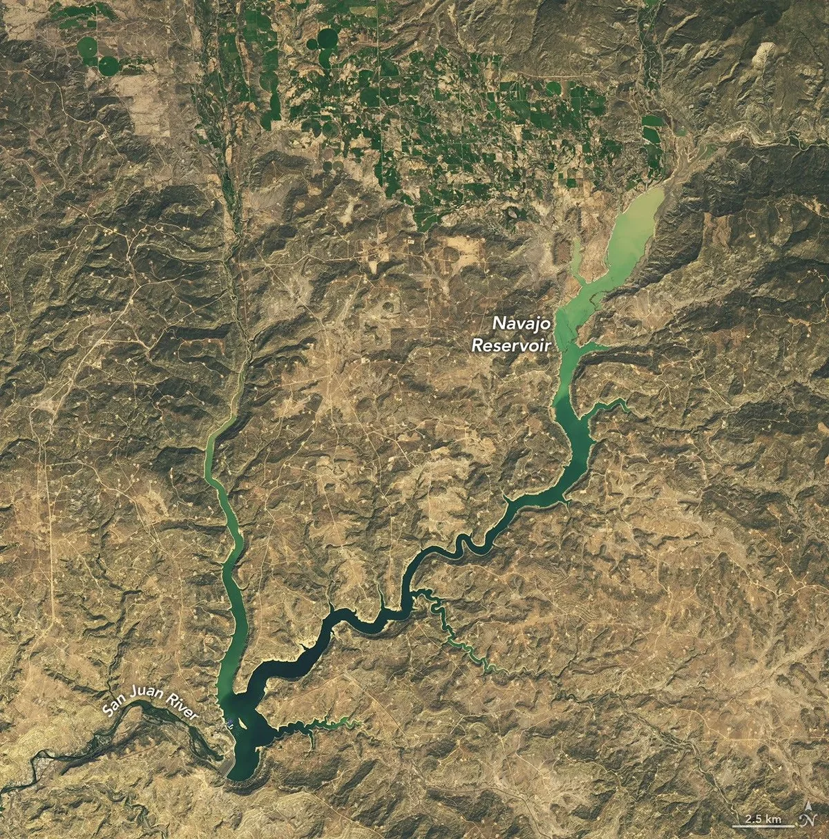
Intense Weather Systems Across the Southwest
Successive rounds of torrential rainfall across the southwestern United States have triggered widespread river flooding, dramatically altering regional drainage networks. Monitored through NASA's Earth observation assets, these extreme precipitation events have brought rapid hydrological shifts to a territory that frequently faces persistent arid conditions. The intense deluge funneled unprecedented volumes of runoff into principal river channels, overwhelming local waterways and rapidly transporting water downstream.
Surging Volumes in the Navajo Reservoir
The primary recipient of this substantial surge has been the Navajo Reservoir, recognized as the second-largest water storage reservoir in New Mexico. Continuous inflows from swollen tributary rivers catalyzed a swift and pronounced rise in the reservoir's water elevation. Remote sensing satellites and hydrological sensors recorded the notable expansion of the water body's surface footprint and the accompanying modification of surrounding shorelines. Such rapid replenishment events present operational demands for water resource managers tasked with balancing flood mitigation and long-term storage.
Earth System Science and Regional Water Security
Satellite-based monitoring of Earth's surface water dynamics provides vital perspective on how abrupt meteorological events impact vulnerable watershed networks. In semi-arid environments that fluctuate between extended droughts and acute precipitation surges, spaceborne observations deliver crucial data for environmental resilience. Scientists and civil planners utilize these orbital measurements to calibrate hydrological forecasting models, monitor ecosystem stability, and optimize infrastructure management protocols amid evolving climate patterns.




Comments
Loading comments...