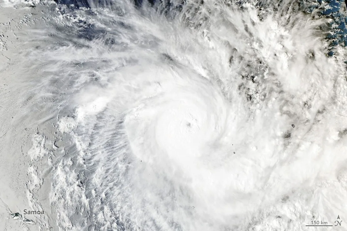
Intensifying Activity in the Pacific Basin
While an unusually subdued storm season drew to a close across the North Atlantic, atmospheric dynamics shifted dramatically on the opposite side of the globe. Conditions across the Southwest Pacific prompted the development of powerful oceanic convective systems. Through its Earth Observatory, NASA monitored the emergence of this significant meteorological event, capturing detailed orbital perspectives and tracking the cyclone's rapid evolution across oceanic expanses.
Meteorological Tracking and Cyclone Evolution
On November 15, 2026, the Fiji Meteorological Service initiated tracking on a slow-moving tropical disturbance situated northeast of Samoa and the Cook Islands. Over subsequent days, atmospheric conditions catalyzed rapid intensification of the low-pressure center. The weather system swiftly consolidated into one of the most intense November tropical cyclones documented in the region in recent decades, generating widespread gale-force winds and extensive convective cloud bands.
Satellite Remote Sensing and Climate Monitoring
Remote sensing imagery provided by Earth-observing satellites captured the internal structure, eye formation, and expansive spiral bands of the storm system in high detail. These spaceborne measurements play an indispensable role in assessing severe weather hazards and delivering actionable information to vulnerable island communities. Researchers continue to utilize such observational datasets to refine forecasting models and understand climate-driven variations in tropical storm intensity.

Comments
Loading comments...