Tracking Disasters from Orbit via Nighttime Lights
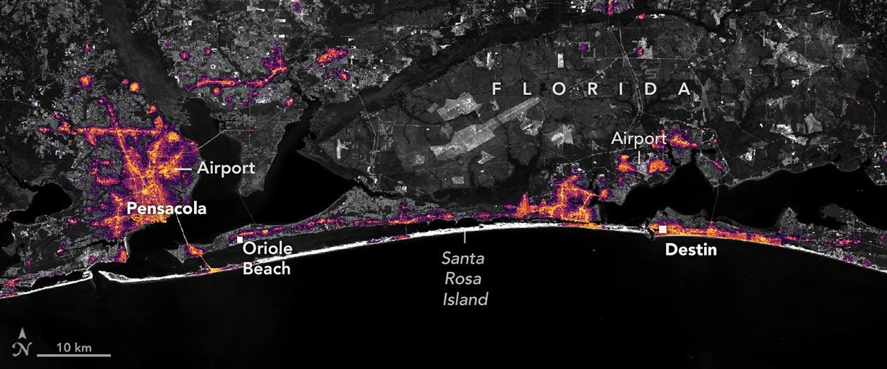
NASA's Earth-observing satellites have tracked the infrastructure impacts of Hurricane Isaias directly from space. By leveraging high-definition nighttime lights imagery, researchers and response teams were able to observe how the severe storm impacted coastal energy systems.
Mapping Blackouts Across the Florida Panhandle
The imagery clearly delineated the regions along the Florida Panhandle where the hurricane knocked out electrical power. Crucially, the orbital observations also documented the timeline of power restoration, showing how rapidly illumination returned to affected communities.
The Role of Remote Sensing in Disaster Response
Satellite-based nocturnal luminosity measurements serve as critical tools for evaluating damage and organizing emergency response after extreme weather events. The data provide objective, large-scale views of infrastructure resilience and recovery timelines.

Comments
Loading comments...